The Great Arc
The Dramatic Tale of how India was Mapped and Everest was Named
John Keay
Who hasn't heard the name Everest? But who knows that the Everest I'm referring to is Sir George Everest (pronounced Eve-rest)? Or William Lambton?
Lambton died in 1823, 178 years ago; famous and a giant in the scientific community. Everest died in 1866, only 135 years ago; even more famous than Lambton. Yet neither has a statue erected in their memory. They were soon forgotten because of the astonishing advances during the 19th century. Yet their work, The Great Indian Arc of the Meridian, was called "one of the most stupendous works in the whole history of science", and "as near perfect a thing of its kind as has ever been undertaken". This wasn't just an attempt to survey or measure a subcontinent; they were also attempting to measure the precise curvature of the globe.
It is astonishing how well they succeeded. They calculated the length of a base line by triangulation from about 200 miles away to be 7.19 miles. Measured with an accurate chain, the actual length differed from the calculated length by just 3.7 inches. Or expressed another way, 1 part in 123,000.
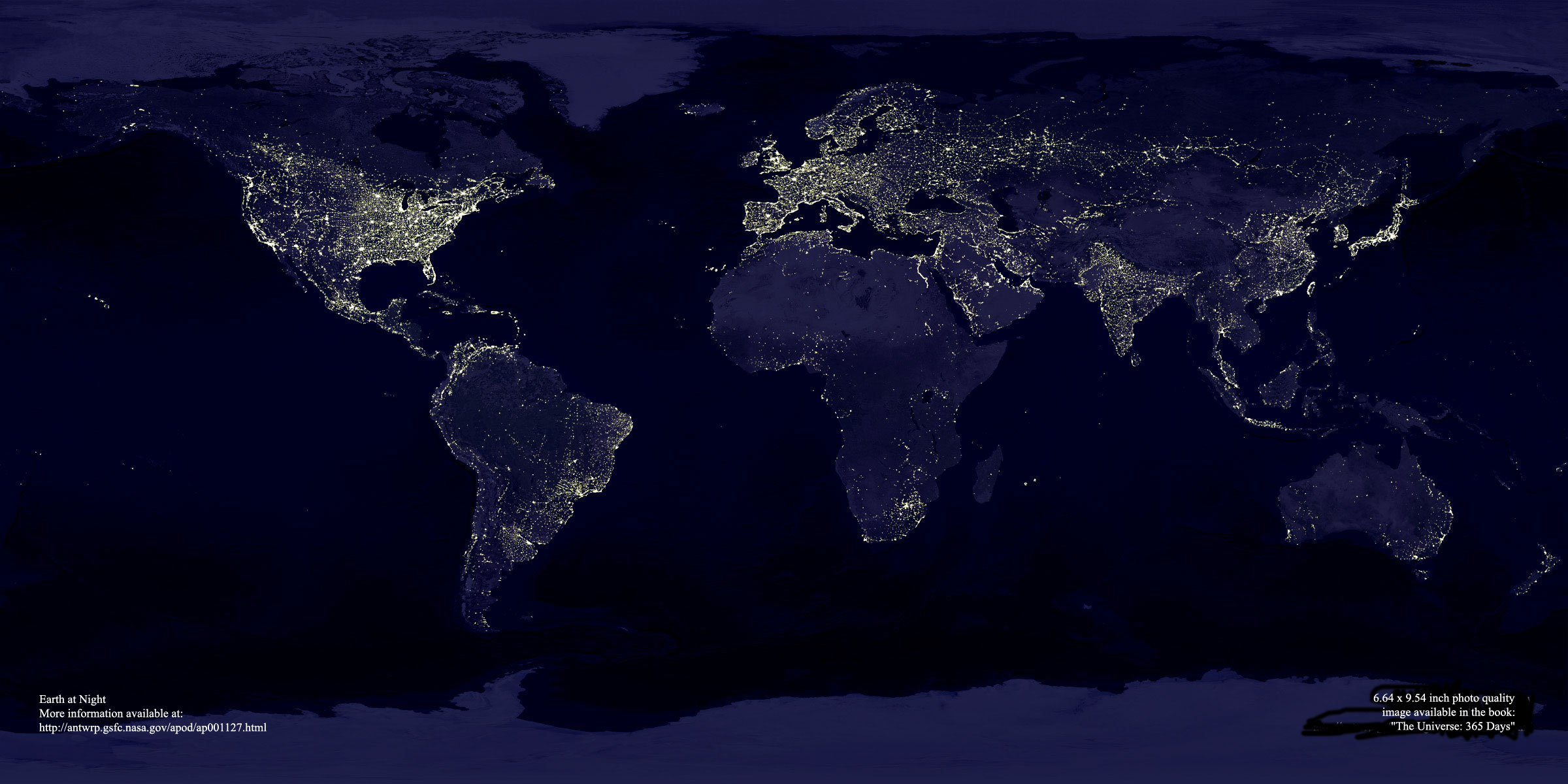
I very much enjoyed this book. It touches on many aspects of mapping, history, mathematics, and personalities, yet is lively and readable. I read the book shortly after seeing a composite photograph of the earth at night that just fascinated me. It's my current desktop image on my computer at work. If you look carefully you'll see that the brightly lit portion of India matches up to the extent of the colonial empire. Or is that just a coincidence? After England and France, India was the most carefully mapped area on earth. Mapping the territory is closely related to taking possession of it.
The Great Arc discusses the difficulties that the surveyors faced. It wasn't just murderous terrain, terrible weather, and poor seeing conditions from smog and smoke. The local people were often suspicious of their activities, tearing up marker posts and denying them access to hills. Many couldn't understand what was happening, because maps were made by pen and paper along a particular route. They were amused that the surveyors often had to ask for directions. The equipment was huge and ungainly by modern standards, and the calculations filled entire libraries.
The book includes a number of photographs, drawings, and maps that add to the enjoyment of the book. But then, I enjoy looking at old photographs and maps. I'd certainly buy it if I were to see it in a used bookstore.
Harper Collins 2000
ISBN 0 00 257062 9